The Challenging Forecast of the 2023 Atlantic Hurricane Season

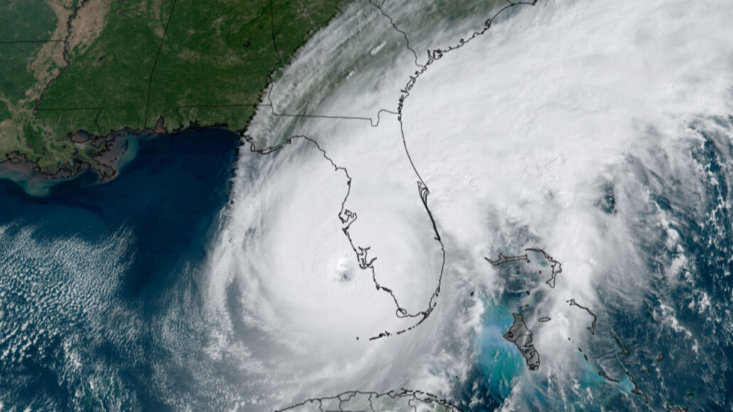
It’s hard to know how busy this year’s Atlantic hurricane season will be, thanks to a rarely observed combination of ocean and climate conditions.
The Atlantic Ocean is in an active storm era, a yearslong period of increasing storm activity. Plus sea surface temperatures there are much higher than usual this year, which can fuel storms, Matthew Rosencrans, the lead hurricane forecaster for the U.S. National Oceanic and Atmospheric Administration, said May 25 at a news conference. But this year will also see the onset of an El Niño phase of the El Niño-Southern Oscillation ocean and climate pattern, which tends to suppress hurricane formation.
That’s not a scenario that has occurred in historical records often, Rosencrans said. “It’s definitely kind of a rare setup for this year.”
He and his colleagues reported that there’s a 40 percent chance that Atlantic hurricane activity will be near normal this year. Near normal is actually unusually high for an El Niño year. But there’s also a 30 percent chance that activity will be above normal, and a 30 percent chance it’ll be below normal.
Overall, the agency is predicting 12 to 17 named storms, of which five to nine are predicted to become hurricanes, with sustained wind speeds of at least 119 kilometers per hour (74 miles per hour). Between one and four of those hurricanes could be category 3 or greater, with wind speeds of at least 178 kph (111 mph). The Atlantic hurricane season officially begins on June 1 and ends November 30.
There’s little consensus among other groups’ predictions, in part due to the uncertainty of what role El Niño will play. On April 13, Colorado State University, in Fort Collins, announced that it anticipated a below-average season, with just 13 named storms, including six hurricanes. On May 26, the U.K. Meteorological Office announced that it predicts an extremely busy hurricane season in the Atlantic, with 20 named storms, including 11 hurricanes, of which five could be category 3 or greater. The long-term average from 1991 to 2020 is 14 named storms.
So far, 23 different groups have submitted predictions for the 2023 Atlantic season to a platform hosted by the Barcelona Supercomputing Center in Spain, which allows users to compare and contrast the various predictions. There’s a large spread among these predictions, ranging “from below average to well above average,” says Philip Klotzbach, an atmospheric scientist at Colorado State University who is responsible for the group’s seasonal Atlantic hurricane forecasts.
That spread is likely the result of two big sources of uncertainty, Klotzbach says: the strength of the El Niño (and when during the year it’s expected to develop), and whether the Atlantic’s surface water temperatures will stay above average.
Each group’s forecast is based on a compilation of many different computer simulations of ocean and atmospheric conditions that might develop during the hurricane season. How often those models agree leads to a probability estimate. NOAA’s models struggled to agree: “That’s why probabilities are not 60 to 70 percent,” Rosencrans said. “That’s to reflect there’s a lot of uncertainty this year in the outlook.”
Get great science journalism, from the most trusted source, delivered to your doorstep.
An emerging El Niño phase is signaled by abnormally warm waters in the equatorial Pacific Ocean, which in turn is tied to shifts in wind strength and humidity around the globe. One of the ways that El Niño tinkers with climate is that it alters the strength of winds in the upper atmosphere over the northern Atlantic Ocean. Those stronger winds can shear off the tops of developing storms, hampering hurricane formation. Warmer ocean waters like those in the Atlantic right now, on the other hand, fuel hurricanes by adding energy to storm systems. How active a season it will be depends on which of those two forces will prevail.
The Met Office, for example, reported that its climate simulations suggest that the wind shear due to this year’s El Niño will be relatively weak, while surface ocean temperatures will remain well above average. Similarly anomalously warm waters in 2017 were found the be the primary cause behind that year’s glut of intense Atlantic hurricanes (SN: 9/28/18).
In the future, hurricane forecasts could become ever more uncertain. It’s unknown how climate change will affect large-scale ocean and climate patterns such as the El Niño-Southern Oscillation in general (SN: 8/21/19). Computer simulations have suggested that as the atmosphere warms, these globe-scale “teleconnections” may become somewhat disconnected, which also makes them potentially harder to predict (SN: 2/13/23). Climate change is also expected to increase ocean temperatures.
Meanwhile, on the other side of the world, the Pacific Ocean’s hurricane season has already begun with a powerful storm, Super Typhoon Mawar, which battered Guam as a category 4 cyclone before roaring toward the Philippines on May 25, strengthening to category 5.
Our mission is to provide accurate, engaging news of science to the public. That mission has never been more important than it is today.
As a nonprofit news organization, we cannot do it without you.
Your support enables us to keep our content free and accessible to the next generation of scientists and engineers. Invest in quality science journalism by donating today.


