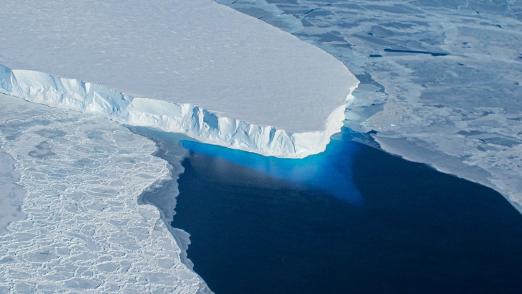
Thwaites Glacier's Rapid Melting Caused by Warm Water Seeping Below

The covertly warming ocean in Antarctica is gradually eroding the foundation of a major glacier through an unknown route. Daily rising tides lead to an incremental upward lifting of Thwaites Glacier at the southern continent's coastal terminus. This causes warm salty water to slip beneath the glacier as indicated by satellite measurements. The seawater permeates several kilometers inland, melting the ice from the bottom up. The mixture of meltwater and seawater is subsequently pushed back out when the tide recedes, as reported in the Proceedings of the National Academy of Sciences on May 20.
According to Theodore Scambos, a glaciologist at the University of Colorado Boulder, "this is going to greatly accelerate the retreat" of the ice in some areas. Thwaites Glacier is part of the West Antarctic Ice Sheet, an Alaska-size dome of ice constantly threatened by warm, dense, salty ocean currents. Particularly vulnerable is the coastline area where Thwaites, a rapidly moving ice channel approximately 120 kilometers wide, drains into the ocean. Precariously, Thwaites currently sheds roughly 75 billion tons of ice per annum, accounting for about half of the total ice loss from all of Antarctica.
Notably, Thwaites Glacier and a large portion of the West Antarctic Ice Sheet rest on a gravelly bed that is scores of meters beneath sea level. This makes the ice susceptible to warm, salty ocean currents that remain close to the seafloor. As the grounding line recedes, friction on the glacier's bed decreases, enabling the glacier to dislodge ice into the ocean at a faster rate which contributes to rising sea levels, Eric Rignot, a glaciologist at the University of California, Irvine explains.
Rignot has monitored Thwaites’ grounding line for two decades using intermittent satellite radar measurements. In 2023, however, Rignot and his team used a new satellite set, ICEYE, to conduct this task three times daily, leading to some unexpected findings. Every high tide pushes a thin layer of seawater beneath the ice sheet, moving six to twelve kilometers inland. Satellite radar revealed the top surface of the ice rising and falling along with the water movement underneath it. Roughly, 200 million cubic meters of seawater move in and out daily — the equivalent of approx 400 times the volume of the world's largest oil tanker.
Although the seawater is only slightly warmer than the melting point of ice, it poses a significant threat due to its salt content which hastens melting, Rignot suggests. His team estimates this could melt an annual twenty meters from the bottom of the ice — about the height of a five-story building.
Christine Dow, a glaciologist at the University of Waterloo in Canada, found that seawater tends to migrate underneath the ice in broad areas between the subglacial freshwater rivers, where it can flow freely across level or downward-sloping terrain. Pressure differences also make it easy for the ice to lift in these areas. She believes that this type of saltwater intrusion has the potential to double the rate of ice loss in some glaciers. Recent advancements could potentially explain why the grounding lines of two neighboring glaciers, Pope and Smith, retreated two to four kilometers in a single year.
Dow believes this tidal intrusion is a phenomenon we just haven’t known to look for. Like her, Scambos agrees that this new development needs to be incorporated into computer simulations that predict future ice loss and sea level rise.


