"Space Station View: The Uncharted Wilds of Tasmania"
Photograph of Australia’s island state of Tasmania captured on January 5, 2024, by an astronaut aboard the International Space Station.
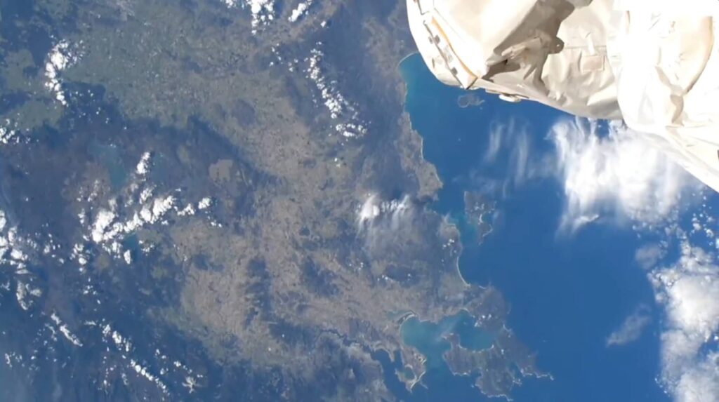
The island is Australia’s smallest state, but its mainland fills the frame of this astronaut photograph.
An astronaut aboard the International Space Station (ISS) took this photo of Australia’s island state of Tasmania while the station orbited almost directly overhead. From this vantage point, the island’s broad geographic features stand out, including its rugged terrain and coasts.
Along the west coast, a line of bright tan beaches contrasts with the darker waters and mountainous interior. Clouds cover much of the northern part of the island. Mainland Tasmania spans about 400 kilometers (250 miles) at its widest, from roughly north to south. Some of the state’s smaller islands lie outside the scope of this scene, including several in the Bass Strait. The strait separates Tasmania from the nearby Australian mainland.
The photo’s wide field of view, achieved with a relatively short focal-length lens, makes roads and towns difficult to see, though both are found throughout the island. Approximately half a million people live in Tasmania. The capital city of Hobart lies on the south end of the island, where the River Derwent meets the ocean.
Agricultural land is interspersed across the island’s inland and coastal areas. To the north, agriculture plots dominate the relatively flat land. In contrast, the terrain to the south (north of Hobart) is characterized by agricultural plots selectively etched into the hillsides.
Less infrastructure has been developed in the west-central part of the island, where protected land, such as the Central Plateau Conservation Area, makes up much of the Central Highlands region. This region also includes several large lakes, such as Lake Gordon.
Astronaut photograph ISS070-E-53369 was acquired on January 5, 2024, with a Nikon D5 digital camera using a focal length of 32 millimeters. It is provided by the ISS Crew Earth Observations Facility and the Earth Science and Remote Sensing Unit, Johnson Space Center. The image was taken by a member of the Expedition 70 crew. The image has been cropped and enhanced to improve contrast, and lens artifacts have been removed. The International Space Station Program supports the laboratory as part of the ISS National Lab to help astronauts take pictures of Earth that will be of the greatest value to scientists and the public, and to make those images freely available on the Internet.