Scientists Found Convincing Evidence of a Seismic Megaquake in the Ocean

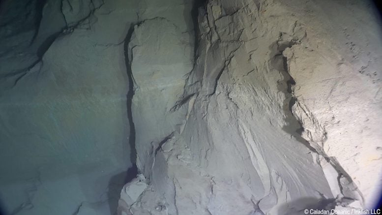
A vertical cliff composed of soft mud, initially located at the bottom of the Japan Trench, was raised about 60 meters due to the 2011 megaquake. This marked the first recorded observation of a fault scarp linked to a trench-type earthquake. The image is credited to Niigata University.
On September 4, 2022, Hayato Ueda, a geologist associated with Niigata University, embarked on an underwater expedition. Accompanied by pilot Chris May, Ueda set out to explore the Japan Trench - the notable location of the devastating 2011 Tohoku-oki earthquake and tsunami. The pair descended around 7,500 meters, to the floor of the trench, discovering there an almost-vertical 26-meter cliff on the eastern side of a 60-meter ridge.
Earlier bathymetric surveys taken from the sea surface had revealed that the ridge materialised only after the megaquake, complete with a fault on its eastern flank. Ueda and his fellow scientists consequently determined that the cliff was a surface manifestation of the movement of the fault coinciding with the earthquake. The cliff was made up of loosely consolidated soft mud. Large quantities of debris from the same blocks of soft mud were observed occupying the lower slope. This debris had apparently originated from the cliff.
The expedition vehicle navigated the ridge over the fault, accurately measuring the topography using a pressure gauge and an acoustic transponder. The resulting data indicated a fault slip in the Japan Trench that was between 80 to 120 meters, directly linked to the uplift and height of the ridge.
The vehicle, capable of reaching depths of 11,000 meters, has scholars referring to it as a “full-depth submersible.” It allowed researchers to approach the bottom of the Japan Trench in the earthquake's epicenter for the first time over a decade after the earthquake. If not for this submersible, the fault scarp in the ultra-deep sea would likely remain unknown. The image is credited to Niigata University.
The superseding fault slip estimated previously, which was approximately 65 meters, was beneath the slope on the trench's western axis. The team attributed the additional movement to variations on the subducting Pacific plate's top surface, which modified the fault's geometry and stability.
The boundary fault between Japan's northeast Honshu Island (Okhotsk plate) and the subducting Pacific plate rupturing and slipping was the cause of the 2011 megaquake. Following the earthquake, many geodetic and geophysical studies proposed that the fault movement likely extended to the trench. However, despite being one of the primary causes of tsunamis, access to the Japan Trench bottom had remained impossible for all manned or remotely operated submersible vehicles due to the extreme depths involved.
This study is the first to both observe and accurately measure the topographic changes in the trench caused by a single trench-type megaquake event, including the fault cliff. It confirmed that the fault slip during the 2011 event definitely spread to the surface, with local measurements indicating that the slip was at least 100 meters in places. These findings are anticipated to aid in understanding the genesis and threats posed by tsunamis triggered by trench-type earthquakes.


